

|
METRIC |
IMPERIAL
|
Updated: 16-Apr-2024 @ 2:15am | |||||||||||||||||||||||||||||||||||||||||||||||||||||||||||||||||||
| Temperature | Current Conditions | Forecast / Storm Prediction | ||||||||||||||||||||||||||||||||||||||||||||||||||||||||||||||||||
|
|
|
||||||||||||||||||||||||||||||||||||||||||||||||||||||||||||||||||
| Dew Point | Liquid Precipitation | Wind Speed | Sun/Moon | |||||||||||||||||||||||||||||||||||||||||||||||||||||||||||||||||
|
|
|
|
|||||||||||||||||||||||||||||||||||||||||||||||||||||||||||||||||
| Humidity | Barometer | |||||||||||||||||||||||||||||||||||||||||||||||||||||||||||||||||||
|
|
|||||||||||||||||||||||||||||||||||||||||||||||||||||||||||||||||||
| Heating Degree Days | Coming Soon | Wind Chill | Air | |||||||||||||||||||||||||||||||||||||||||||||||||||||||||||||||||
|
|
|
|
|||||||||||||||||||||||||||||||||||||||||||||||||||||||||||||||||
| UV Summary/Forecast | Solar Summary | |||||||||||||||||||||||||||||||||||||||||||||||||||||||||||||||||||
|
|
|||||||||||||||||||||||||||||||||||||||||||||||||||||||||||||||||||
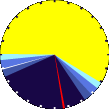
| Almanac | Station All Time Records | Cloud Level | ||||||||||||||||||||||||||||||||||||||||||||||||||||||||||||||||||
|
|
|
|
|||||||||||||||||||||||||||||||||||||||||||||||||||||||||||||||||


| 1 Rain season: Jan 1st to Dec 31st. 6 Air Quality Index is provided by Minnesota Polution Control Agency and is updated hourly between the hours of 6AM and Midnight. 10 Historical average only to day 16 of just the month of April for this station since 2013. 11 Historical average rain this season to day 16 of April for this station since 2013. |
| Weather Forecast - Outlook Overnight & Tuesday | ||||||||||||||
|
||||||||||||||
|
||||||||||||||
|
||||||||||||||


| Current Conditions | |||
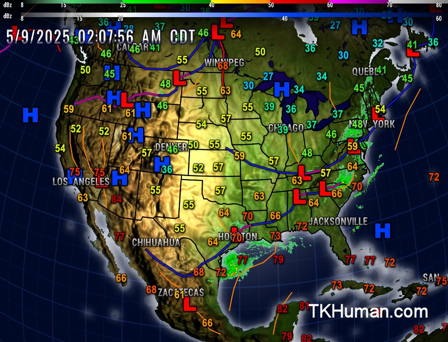 | |||
| US Fronts from NWS | |||
 | |||
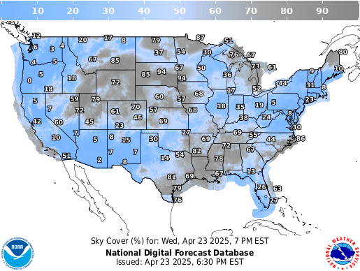
| Sky Cover from the NWS | |||
 | |||
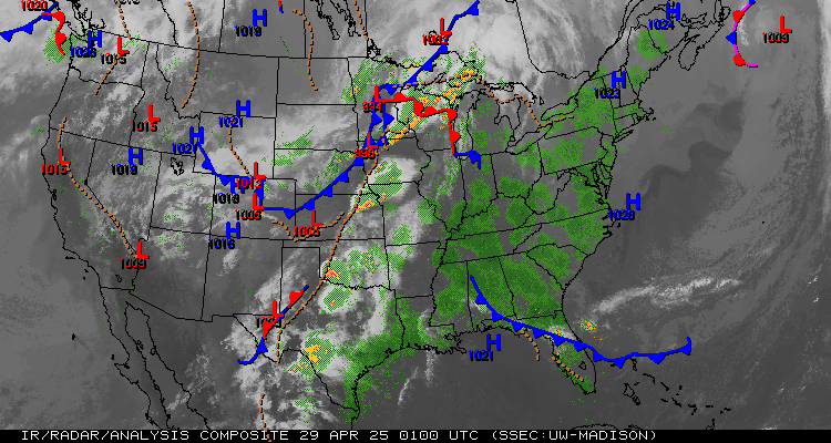
| Current Sat/Rad/Fronts from SSEC.edu | |||
 | |||
| NWS Regional Radar Loop | |||
| Weather Underground Regional Radar Loop | |||
 | |||
| NWS National Radar Loop | |||
| Weather Underground Current US Radar | |||
 | |||
| Current Watches and Warnings | |||
 |
|||
| Regional Satellite | |||
| |||
| Current US Satellite Provided courtesy of UW-Madison SSEC" | |||
 | |||
| Current US Satellite Animation Provided courtesy of NOAA" | |||
 | |||
| Jetstream from WeatherUnderground.com | |||
 | |||
| Tropical Update | |||
 | |||
| Sea Surface Tempeatures from SSEC.wisc.edu | |||
 | |||
